The sky’s the limit
High-tech aerial photography speeds disaster response

An Aero Commander aircraft lifts off from William P. Hobby Airport in Houston, Texas, USA.
The plane climbs out over the Gulf of Mexico and then banks east.
The pilot and one passenger are making the short flight to Lake Charles, Louisiana, which had been battered by Hurricane Laura just a few days before. The plane carries just one piece of cargo, which will help speed relief to those upended by the storm.
On board is a US$1.5 million camera the size of a small refrigerator. The pilot and camera operator will spend the next few hours painstakingly photographing the devastation in Lake Charles as well as Beaumont, Texas, and the surrounding area.
On the ground, FM Dallas Operations Chief Engineer Frank Liserio waits anxiously for the photos. The high-resolution images will help guide FM’s engineering and claims response to the hurricane. The photos will allow FM to identify damaged facilities quickly, mitigate any further damage and get clients up and running as quickly as possible. It is just one way that FM is using technology to better serve its customers.
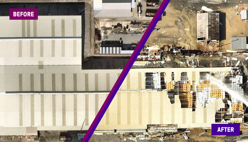
It is the first time FM is responding to a hurricane with the help of gray sky photography from the Geospatial Insurance Consortium (GIC). The GIC is an initiative of the National Insurance Crime Bureau. Member organizations share the cost of creating digital aerial imagery of the U.S., Canada, New Zealand, and Australia (and soon Europe). Following a natural disaster, the GIC flies back over the affected area, giving insurance companies detailed before-and-after images, aiding the response on the ground.
Cutting-edge photographs
“The GIC is using the latest in high-tech digital photography and we’re able to integrate that directly into our engineering platform,” explains Karl Meredith, principal research scientist and head of the GIC project at FM. “It gives our engineers and claims adjusters a bird's-eye view of the properties we insure. Ultimately, it allows us to really understand what’s happening on the ground, gives us better information to make recommendations and respond quicker to our clients’ needs, especially after a natural disaster.”
Less than 24 hours after the flight, Liserio has the images. Three FM engineers pore over the pictures, zeroing in on FM-insured properties. The photos are a remarkably clear record of the devastation and allow Liserio, the engineering disaster coordinator for Hurricane Laura, to deploy his engineering team efficiently.
“Following a disaster, we conduct post-canvassing to understand the losses our clients have incurred and help stabilize those losses,” Liserio explains. “We then move to loss investigation. The gray sky technology helped us understand the scope of the loss and we were able to move immediately to loss investigation.”
Normally, it can take days to reach insured properties after a natural disaster. Flooding, closed roads, the lack of power and a shortage of gasoline often hamper the canvassing efforts. With the GIC aerial imaging, FM engineers were able to “visit” 50 locations in a matter of hours.
Half the time, half the staff
“I had 12 engineers ready to respond to Hurricane Laura,” Liserio adds. “After the gray sky work, I was able to cut that to six. Normally, we would spend two weeks responding to losses after an event like this. With gray sky, we were there for only five days with half the staff.”
The images provide incredible detail and offer information that even those on the ground might not have. At one client location, Liserio explains, the gray sky images showed that a piece of roof-mounted equipment had shifted, creating a hole in the roof. The client had been unaware of the damage.
“They reported no damage from the storm and weren’t planning on sending anyone up on the roof,” he adds. “Without the gray sky images alerting them to the damage, they would have had a significant amount of water in the building the next time it rained.”
The story was very much the same for FM’s claims response team. Once a covered loss has been identified, the claims team fans out in the area, working directly with clients to process those claims as quickly as possible. This ensures the clients have the funds to make repairs and limit business interruption. The gray sky imagery helped speed that process.
“It made our job a lot easier knowing where to concentrate our efforts,” explains Jeff Elizeus, senior general adjuster and claims catastrophe coordinator for FM. “It shows us where the big losses are and reduces our response time. It also shows us if there is damage further inland and if we’ll need a satellite office to handle the claims in another area.”

Blue sky technology
While the GIC images are incredibly valuable after a hurricane, flood, wildfire, tornado or even an explosion or other disaster, the “before” pictures are equally useful to insurance companies.
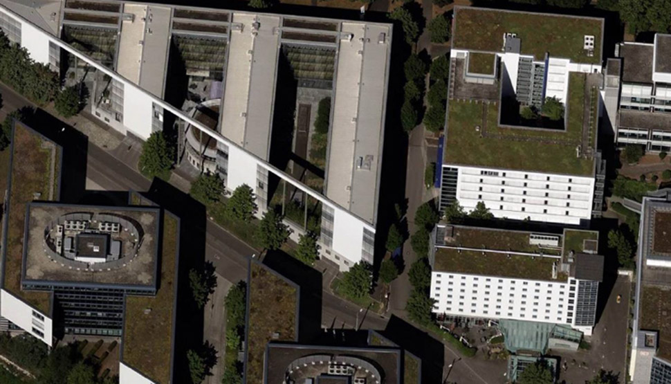
Using its own aircraft and pilots, the GIC photographs every inch of the continental U.S. every two years. About 70% of the U.S. is photographed every year. The imagery is shot from an altitude of about two miles, giving a “blue sky” look at the country that can’t be found in satellite imagery.
In addition to the vertical images shot straight down, the GIC cameras capture oblique images, collected at a 45-degree perspective. This provides a detailed 360-degree view of a property. Near-infrared images are also captured, optimal for classification of vegetation and wildfire fire risk.
“The blue sky images are very useful when you’re preparing for a site visit,” explains FM’s Mike Eckroth, operations engineering manager. “The historic images are also helpful so you can see the changes that have happened on a property, particularly when dealing with construction projects.”
Other available analytics tools can help in assessing properties and the GIC is developing tools using artificial intelligence to pinpoint areas of heavy damage after a natural disaster. The tools are helpful, Eckroth says, but the real value when trying to drive risk improvements comes from the images themselves.
“If you have a lot of clients in a hurricane area, it can be hard to get to every wind-prone location,” he adds. “With blue sky, you can send the client a picture of their nine pieces of roof-mounted equipment along with instructions on how to secure that equipment well before a hurricane strikes.”
