Three reasons america’s wildfire costs will continue to get worse

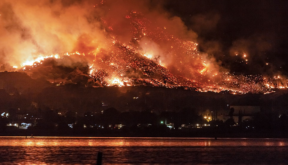
Rarely is the power of nature more fearsome than in a wildfire, and this season has so far claimed at least 40 lives, more than 7.5 million acres, and more than 7,000 structures in the US, forcing hundreds of thousands of evacuations.
As destructive as they are, the flames themselves are only part of the problem. Also disrupting lives and businesses are smoke damage, power and communication loss, surface water contamination, and forced evacuation. As with all natural hazards, wildfire severity fluctuates quite broadly from year to year. The long-term trend, in both cost and acres burned, is definitely upward.
Top 10 Costliest Wildland Fires in the United States (1)
($ millions)
| Estimated insured loss | ||||
|---|---|---|---|---|
| Rank | Date | Name, Location | Dollars when occurred | In 2019 dollars (2) |
| 1 | Nov. 8-25, 2018 | Camp Fire, CA (3) | $8,500-$10,500 | $8,700-$10,700 |
| 2 | Oct. 8-20, 2017 | Tubbs Fire, CA (3) | 7,500-9,700 | 7,800-10,100 |
| 3 | Nov. 8-22, 2018 | Woolsey Fire, CA (3) | 3,000-5,000 | 3,100-5,100 |
| 4 | Oct. 8-20, 2017 | Atlas Fire, CA (3) | 2,500-4,500 | 2,600-4,700 |
| 5 | Dec. 4-23, 2017 | Thomas Fire, CA (3) | 1,500-3,500 | 1,600-3,600 |
| 6 | Oct. 20-21, 1991 | Oakland Hills Fire, CA | 1,700 | 2,900 |
| 7 | Oct. 21-24, 2007 | Witch Fire, CA | 1,300 | 1,600 |
| 8 | Jul. 23-Aug. 30, 2018 | Carr Fire, CA (3) | 1,000-1,500 | 1,000-1,500 |
| 9 | Oct. 25-Nov. 4, 2003 | Cedar Fire, CA | 1,060 | 1,400 |
| 10 | Oct. 25-Nov. 3, 2003 | Old Fire, CA | 975 | 1,300 |
Insurance Information Institute, catastrophe risk modelers, reinsurance companies, the California Department of Insurance, the Property Claim Services® (PCS®) unit of ISO®, a Verisk Analytics® company, and the U.S. Bureau of Economic Analysis.
Here are three main reasons why wildfires losses are increasing and fires are getting larger over the long term:
1. Value at risk
Homes built in forested or highly vegetated areas have always been at risk and continue to be the most vulnerable. Communities continue to develop near wildfire-prone areas without adequate cleared space for fire breaks and basic measures to prevent burning embers (which can travel miles) from igniting buildings and the surroundings. As the population grows, so does the value at risk. Urban plans need to be smarter. Those same communities are getting more expensive as well. For example, median prices for single-family detached homes in California have risen by 263% since January 1990, far faster than inflation. The higher the value, the bigger the loss. Not much can be done about that.
2. Forest management challenges
A few decades ago, there was a collective recognition that forest management practices needed to change. Fuel loading in forests had increased steadily as satellite observations helped locate smaller fires and fight them earlier. This sounds like progress, and it can be helpful, but the general past practices have made wildfires burn faster and hotter as fuels continued to accumulate in many areas. Prescribed burning (where areas are purposefully burned during the time of year when the risk is lower) and forest thinning (where trees are cut down by hand) are expensive and have their own risks. Neither of these measures can scale to the extent needed to protect exposed values.
3. The warming climate
A warming climate exacerbates wildfire by extracting moisture – nature’s flame retardant – from the plant materials that burn. Higher temperatures increase the pace of transpiration – the process by which a plant takes moisture in through the roots and loses it through leaves and needles. All other things being equal, an increase in temperature of 10 degrees Centigrade (from 68F to 86F) can result in a factor of 3 increase in the rate of water loss by transpiration in plants.1
A 20% reduction in moisture content increases the probability of fire spread under modest winds by a factor of 4 for California shrubs (again, all things being equal, like wind speed, fuel loading and slope).2
Given the dynamics of heat and moisture, it makes sense that wildfires are worse than ever when temperatures are at their highest. Southern California has seen a threefold increase in heatwave frequency over the past two decades. Los Angeles County recorded its highest temperature ever on Sept. 6, 2020: 121°F. Death Valley just hit 130° F, perhaps the highest temperature ever recorded on the planet.
The overall process of denser, drier plant material helps explain why some recent fires, such as the Camp Fire of 2018, are burning more intensely and spreading at speeds significantly faster than the wind speed due to the rate at which radiant heat, local flow acceleration, and a storm of burning embers get lofted ahead of the main flames.
Wildfires and their destruction have become a fact of life, and we have to adapt to them becoming a bigger part of our lives in the future. By improving urban planning, construction practices, and proactive (not reactive) fire management, we can help reduce the damage. Let’s get to work.
[1] Paul J. Kramer, John S. Boyer (1995). Relations of plants and soils, Academic Press.
[2] Weise David R., Zhou Xiangyang, Sun Lulu, Mahalingam Shankar (2005). Fire spread in chaparral—‘go or no-go?’. International Journal of Wildland Fire 14, 99-106. Study involved chamise, a shrub-type plant that grows, and burns, in the hills of southern California.
As originally published in Forbes.
Prepare for wildfire and bushfire. Download FM's "Understanding the Hazard: Wildfire and Bushfire" provided free to the public.
